
Hastings Neighbors by Parcel
The public route to nearby-parcel research starts with the physical block, not with a broad name search. Dakota County's map connects a supplied address to a parcel, then lets the user inspect nearby parcels one at a time. Each source has a different boundary. A property card can identify a fee owner and mailing address. A recorded document can identify parties to a transaction. A historical map can show a building's past use. None of those records alone creates a complete list of people who live around the address.
| Block source | What it can show nearby | Access route |
|---|---|---|
| Property Information GIS | Selected parcel, adjacent parcels, municipality, fee owner, mailing address, and legal description | Free address, parcel-ID, or map-click search |
| Property card | Parcel ID, property and mailing addresses, use, plat, lot/block, tax, and building fields | Linked county property result |
| RecordEASE | Recorded parties, legal-description route, document type, date, and image path | Login-gated, fee-bearing county index |
| City maps and Engineering records | Addressing, roads, historic districts, land use, floodplain, and right-of-way context | Map links or a targeted city request |
| MNVotes | An individual's registration match after required identity and address inputs | Person-specific official match, not a block list |
| Historical collections | Directory, map, clipping, photograph, census, or church/cemetery context | DCHS, Pioneer Room, or MNHS research route |
For Hastings neighbors, preserve the distinction between the parcel's property address and the owner's mailing address. They can be different. A county result may identify a legal property role without saying who is currently present there. Keep the parcel ID, municipality, legal description, and record date beside each result so a later map or deed can be compared on the same terms.
Map a Hastings Neighbor Block
Use the parcel map as a repeatable adjacent-parcel method. Search the known address or parcel ID, zoom to the street, then select the side, rear, and across-street parcels one at a time. Do not assume that a parcel across a road, alley, railroad, river, or irregular lot line is the next legal parcel. The map establishes physical proximity; the plat, right-of-way record, and legal description explain the boundary.
- Find the starting parcel in Dakota County Property Information and record its property address, municipality, parcel ID, and legal description.
- Click each nearby parcel and capture the same fields in the same order, including fee owner and owner mailing address where shown.
- For an ownership question, use the legal description in RecordEASE and record the document number, date, document type, and named parties before relying on an image.
- Check the city addressing map, plat, registered land survey, or right-of-way context when the map view makes a boundary uncertain.
- Add a dated historical map or directory lead only after the modern parcel is fixed. Mark the source year and any change in lot, block, or address form.
The Dakota County GIS help page describes the address-result list, parcel selection, and Property, Tax, and Building Information panels.
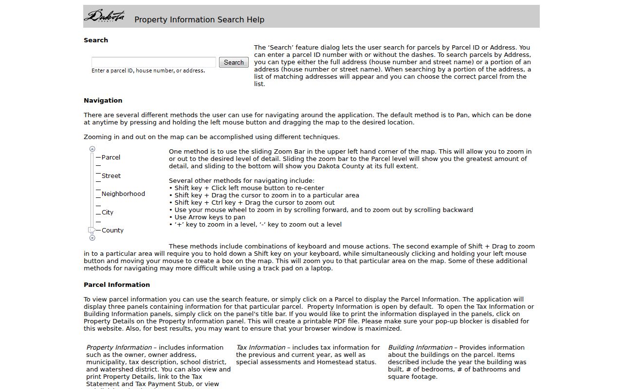
The panel sequence makes a block comparison consistent: record the parcel before reading a building or tax field. For a full named-street chain rather than the immediate block, use the Hastings street directory and its address-by-address research route.
Hastings Neighbor Parcel Fields
A property card is a structured record, not a title opinion. The county sample card lists identity and location fields such as parcel ID, fee owner, mailing address, property address, municipality, sale date and value, acres, use, plat, lot/block, and tax description. It can also carry building facts, district and program fields, current and prior valuation, taxes, and assessments. Reading the same fields for every selected parcel helps separate a missing field from a real difference between properties.
- Parcel ID
- The county's identifier for a property. It is the safest bridge between the map, card, tax data, and recorded-document research.
- Situs address
- The property location used on the parcel record. It is different from an owner mailing address when the two fields do not match.
- Legal description
- The lot, block, addition, survey, or other formal land description used to identify the land in recorded documents.
- Plat
- A recorded map that lays out lots, blocks, streets, and other property lines. It can explain why a visual map boundary is misleading.
The county warns that map data is not a legal document and is not a substitute for title work, appraisal, survey, or a zoning decision. Check the card's data date and treat a sale field as a dated event, not a claim about every person connected to the address.
Hastings Owner Addresses Need Context
A fee owner or mailing address does not prove who resides at the property. That is a key local caution because the GIS system separates the property address and municipality from the owner's mailing address. An owner can use another mailing location, hold property through an entity, or appear in an older record. The right comparison is the parcel/legal description plus date, not a ZIP label or matching surname alone.
Record discipline. For each nearby parcel, keep property address, municipality, parcel ID, legal description, fee owner, mailing address, deed reference, map date, and any historical source separate.
When a deed is needed, Dakota County's online-property-record route describes RecordEASE searches by grantor, grantee, legal description, and document type. Its access is fee-bearing and the live search is behind login. County copy requests are another path when a particular instrument has been identified. That slower route is more reliable than guessing from a list of surnames.
Hastings Block Lines and Maps
Hastings has an early compact grid and downtown core along 2nd Street, followed by later growth along Vermillion Street and TH 61. The 2040 land-use material describes a generally gridded pattern before the 1950s and later curvilinear subdivisions. That history changes how adjacent parcels and old addresses fit together. A historical deed may use a lot and block, while a current parcel card uses a PIN and property address.
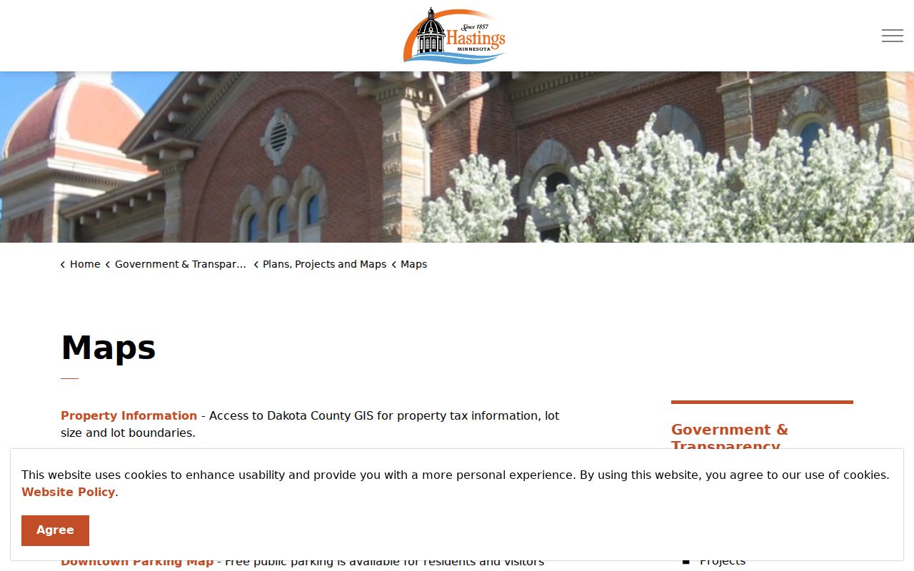
The City of Hastings map collection links current addressing, zoning, historic-district, parcel, land-use, and flood maps.
When an old number will not reconcile, compare street-name variants, the lot/block or addition, Sanborn sheet and date, newspaper legal notices, and Engineering right-of-way records. No verified citywide renumbering or street-renaming year was located in the research, so an apparent mismatch should be documented rather than filled with a guessed conversion.
Note: A map can show physical adjacency, but only the plat, legal description, and right-of-way information establish how parcels relate in the record.
Hastings Voter Match Rules
MNVotes verifies an individual registration only when first name, last name, date of birth, and address details match. In ZIP mode, it asks for ZIP, county, city or township, house number, street, and an optional unit. The system updates nightly, while a new registration can take time to appear after processing. It is not a screen for everyone on a block, and a match does not prove ownership or a complete household.
| MNVotes control | Hastings block-research limit |
|---|---|
| Name and birth date | First name, last name, and month/day/year date of birth are required identity fields. |
| ZIP or county mode | One search mode is required; Dakota can be selected for the county route. |
| Address fields | ZIP mode uses county, city or township, house number, street, and an actual unit when applicable. |
| Result handling | A result is a registration match or next step, not a parcel title, address roster, or proof of household membership. |
| File request | Voter-file requests require a registered Minnesota voter, certification, lawful purpose, and a permitted geography. |
The MNVotes address-search screen shows why a casual block roster is not the portal's design.
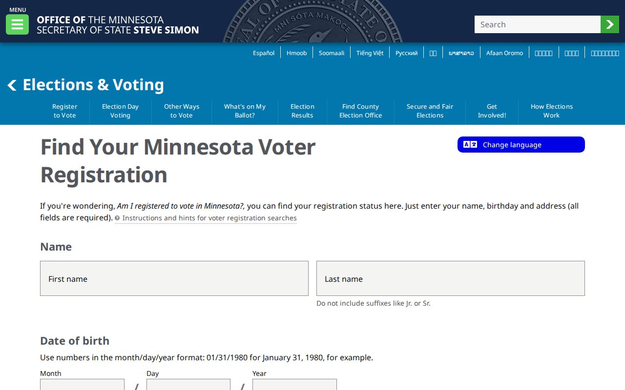
Minn. Stat. §201.091 excludes several protected identifiers from the public voter list. The statewide request form allows defined geographies such as city, precinct, ward, and county, but it still requires the specified requester certification and lawful use. Do not use a failed or successful match to make a claim beyond registration status.
Hastings Community Research Routes
No official citywide neighborhood-association directory or public membership roster was located for Hastings. That gap matters. Social pages and informal lists are not a sound substitute for a public record. The local historical institutions below can help with a block's context, but their holdings are research leads rather than a present-day resident list. Ask each custodian whether a collection is indexed by name, address, year, business, or subject before treating it as a useful route.
Pioneer Room
Hastings Pioneer Room is on the first floor of City Hall and focuses on the city, its town, and its citizens. An online catalog was not located.
Dakota County History
Dakota County Historical Society reports church, cemetery, census, and World War I biography databases, plus local clipping and map leads.
Minnesota History Library
MNHS Library holds maps, newspapers, state archives, municipal and court material, tax records, and walk-in research databases.
For a historical block, use a dated telephone directory entry, clipping, newspaper title, map sheet, or photograph catalog as a lead and then test it against a deed, tax, census, or vital source. A 1945 telephone entry, for example, is a subscriber snapshot and warns that errors or omissions may remain. It cannot prove continuous presence at an address.
Official Hastings Neighbor Tools
Official county and state sources identify their custodian, data type, and limits. Commercial neighbor tools may combine records from many sources, but they do not replace the parcel map, recorded instrument, or lawful voter process. Compare the underlying record before repeating a name or address, especially when a result has no date, source, parcel ID, case number, or other record reference.
| Tool category | Useful for | Limit to keep in view |
|---|---|---|
| County parcel and property records | Parcel geography, fee-owner role, mailing address, legal description, tax, and building context | Not a title opinion or statement of who currently resides there |
| Recorded-document index | Named parties, document type, date, legal-description research, and ordered images | May be fee-bearing, login-gated, or need a clerk-copy follow-up |
| State voter route | A person-specific registration match or lawful certified request | Not a casual household or block roster; protected fields remain closed |
| Commercial lookup category | Potential leads that need source checking | May be stale, mismatched, incomplete, or detached from the actual custodian |
Use the official record to resolve a conflict. A map label should be checked against its parcel card. A recorded party should be checked against the instrument date and legal description. A historical directory result should retain its volume and year. The point is an evidence trail, not a broad profile of the people nearby.
Hastings Neighbor Privacy Limits
Some information is private by law or intentionally limited online. Safe at Home gives eligible Minnesota participants a substitute post-office box while protecting their real location in public-facing government interactions. MCRO restricts sensitive case types and protected addresses. Property cards are public orientation records, but they are not a title search and should not be used to expose unnecessary personal information. There is no verified public screen for every person on a Hastings block.
Lawful use. Use block records for personal, lawful research, community history, or a specific property question. Do not use them to watch, stalk, harass, intimidate, or harm anyone.
If a privacy concern involves voter visibility, use the Secretary of State's Safe at Home or voter-inactivation route. For city data, identify the custodian and make a targeted Minnesota Government Data Practices Act request. A request to one office cannot remove a record controlled by another.
Note: Treat nearby-parcel research as a dated record exercise, and leave unknown household details unknown rather than trying to fill them from a map or name match.