
Hastings Previous Residents by Era
Previous residents of a Hastings address leave different kinds of evidence in different eras. Start with the present Hastings parcel and legal description, then choose the next Hastings source based on the date at issue. A recorded Hastings document may establish a transfer. A Hastings telephone directory may place a subscriber at an address for a given edition. A Sanborn map can describe the Hastings block and building. City files may date work on the property, although their searchable historical coverage was not verified.
Use each Hastings result as a dated piece of the trail. The strongest Hastings past-residents work keeps ownership, occupancy, property condition, and family context in separate columns. A Hastings address may be absent from an index because the source has a gap, a street form changed, or the record uses a legal description rather than a house number.
| Hastings history source | Verified years or period | Where it is held | What it can show |
|---|---|---|---|
| Hastings Property Information GIS and parcel card | Current county information | Dakota County Property Taxation & Records | Parcel ID, fee owner, mailing and property address, legal and tax context |
| Hastings RecordEASE abstract index | Indexed back to July 8, 1993 | Dakota County online land-record system | Recorded parties, legal description, document type, image and copy routes |
| Hastings telephone directories | 1928 to 2010 holdings, with gaps | Minnesota Historical Society finding-aid collection | Dated subscriber name, street address, and telephone evidence |
| Hastings-area Minnesota state-census material | 1865 to 1905 guide coverage | MNHS collections and library research routes | Household and locality evidence when the correct roll and place are checked |
| Hastings Sanborn maps | 1884, 1891, 1898, 1904, 1910, and 1911 | Library of Congress; DCHS has a 1920s map lead | Building, street, block, and use context |
| Hastings City permits and records requests | Current city-held records; historic span not verified | City of Hastings | Work, maintenance, or municipal-file context for a defined request |
For early Hastings research, preserve the original locality label. Hastings county and township custody can differ from today's city label, and a historical Hastings catalog entry may be filed under Ravenna or Dakota County rather than under a modern street name.
Hastings Parcel Facts Before History
Fix the present Hastings parcel before tracing previous residents. The free Dakota County Property Information GIS accepts a Hastings address, a parcel ID, or a map click. Capture the Hastings property address, municipality, parcel ID, legal description, fee owner, and owner mailing address. The county's field design matters: the mailing address can differ from the situs address, and either one can mislead if copied without the Hastings parcel context.
Also save the Hastings sale date and value, tax description, plat, lot or block where shown. Those fields are pointers, not substitutes for an instrument or a survey. The card expressly warns that map data is not a legal document and does not replace title, appraisal, survey, or zoning work. A strong Hastings house history carries that warning forward instead of converting a map result into certainty.
When the Hastings parcel lies near a postal or municipal edge, confirm the county and municipality before ordering a document. The research identifies Hastings as the Dakota County seat, but it also notes an unverified nearby Washington County crossover reference. The Hastings parcel result, not a postal label, controls the county-record route.
Hastings Deed Records and Prior Owners
The Dakota County deed chain provides the legal backbone for Hastings previous residents research, even though deeds identify transfers rather than everyone who lived in a place. Dakota County online property records describes RecordEASE searches by grantor, grantee, legal description, and document type. Begin with the present Hastings parcel's legal description, then test the current or recent owner as a grantee and follow the earlier Hastings transfer.
- Record the current Hastings parcel ID, property address, municipality, legal description, fee owner, and mailing address from the GIS result.
- Search Hastings RecordEASE by legal description and document type, then identify the transfer that brought the most recent grantee into the chain.
- Save the Hastings recording date, instrument number, parties, document type, and book, page, or image reference if the result displays one.
- Search that earlier Hastings seller as a grantee to locate the preceding acquisition, then repeat backward one documented transfer at a time.
- When the chain switches to lot, block, addition, Abstract, or Torrens terminology, compare the county plat and survey record before matching it to a street address.
- Order the relevant image or certified copy only after the index result identifies the needed instrument. Dakota County lists copies at $1 per page and certified copies at $10.
- Grantor and grantee
- The grantor transfers an interest; the grantee receives it. In a purchase deed, the seller is usually grantor and the buyer is grantee.
- Chain of title
- The sequence of recorded transfers that links one ownership interest to an earlier one.
- Legal description
- The recorded land description, such as a lot, block, addition, or survey reference, which can persist when a street address changes.
- Criss-cross directory
- An address-arranged directory, when a verified volume is available, used to connect a dated subscriber with a street and house number.
- Enumeration district
- The census area's geographic unit. It helps place a household in the right locality when modern boundaries differ.
Hastings Deed Index Online Floor
RecordEASE is helpful, but the Hastings online index has a local boundary that should be stated plainly. The county's live login notice says all Abstract and Torrens book, page, and document ranges are digitized, while the Abstract documents are indexed back to July 8, 1993. Earlier Hastings material may therefore need a different route even when an image range is digitized. The public research did not expose the complete post-login search screen or a single historic search cutoff for every document type.
The RecordEASE login makes the Hastings account boundary visible before a researcher assumes a field, filter, or date control is available.
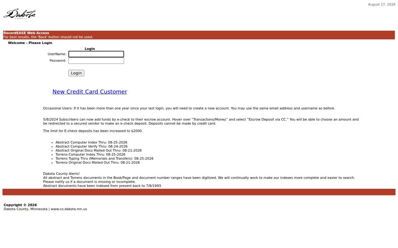
The login capture supports a cautious Hastings handoff to Dakota County's land-record counter or written research route when the online index cannot answer an older transfer question.
For later monitoring, Dakota County Property Watch is a free forward-looking alert service. It can match a name, legal description, or property and report a party name, date, document number, and document type on future recordings. It does not recreate prior ownership, but it is useful after a Hastings parcel has been confirmed.
Hastings Historic Address Changes
Street numbers are often the weakest bridge in a long Hastings address history. The Hastings city developed around an early compact grid and a downtown core along 2nd Street, then expanded along Vermillion Street and TH 61 before later subdivisions introduced curving roads. An old Hastings directory may abbreviate a street type or give a number that needs a lot, block, or addition before it can be compared with a current parcel.
No official source inspected for this project verified a Hastings citywide renumbering year, street-renaming year, or annexation-related renumbering. When a Hastings address drops out of the trail, compare the historic spelling, legal description, county subdivision plat, registered land survey, right-of-way map, Sanborn block, newspaper legal notice, and City Engineering records. A gap should remain a gap until a record ties the old form to the current Hastings parcel.
The county's online plat and survey search supplies Hastings subdivision, CIC, registered-land-survey, and right-of-way map routes that can reconnect a legal description to a physical place.
Hastings Telephone Directories Date Moves
Verified Hastings telephone holdings are a Hastings address timeline, not a complete city directory or a proven reverse directory. The Minnesota Historical Society finding aid lists a 1928 volume, a 1948 volume, broad runs from 1953 through 1968, 1970 through 1986, 1987 through 1995, 1996 through 2004, and holdings through 2010. It also records gaps and duplicate or yellow-page items. Do not fill a missing Hastings year with an imagined edition.
A white-pages entry can connect a Hastings subscriber name, street address, and telephone number for a specific volume. Use it to frame a possible move between dated editions, then test the Hastings address against deeds, tax material, census research, and newspapers. The digitized 1945 Central Telephone Directory warns that errors or omissions may remain, so a listing is a lead rather than proof of continuous occupancy.
The MNHS telephone-directory finding aid inventories the Hastings shelves and formats.
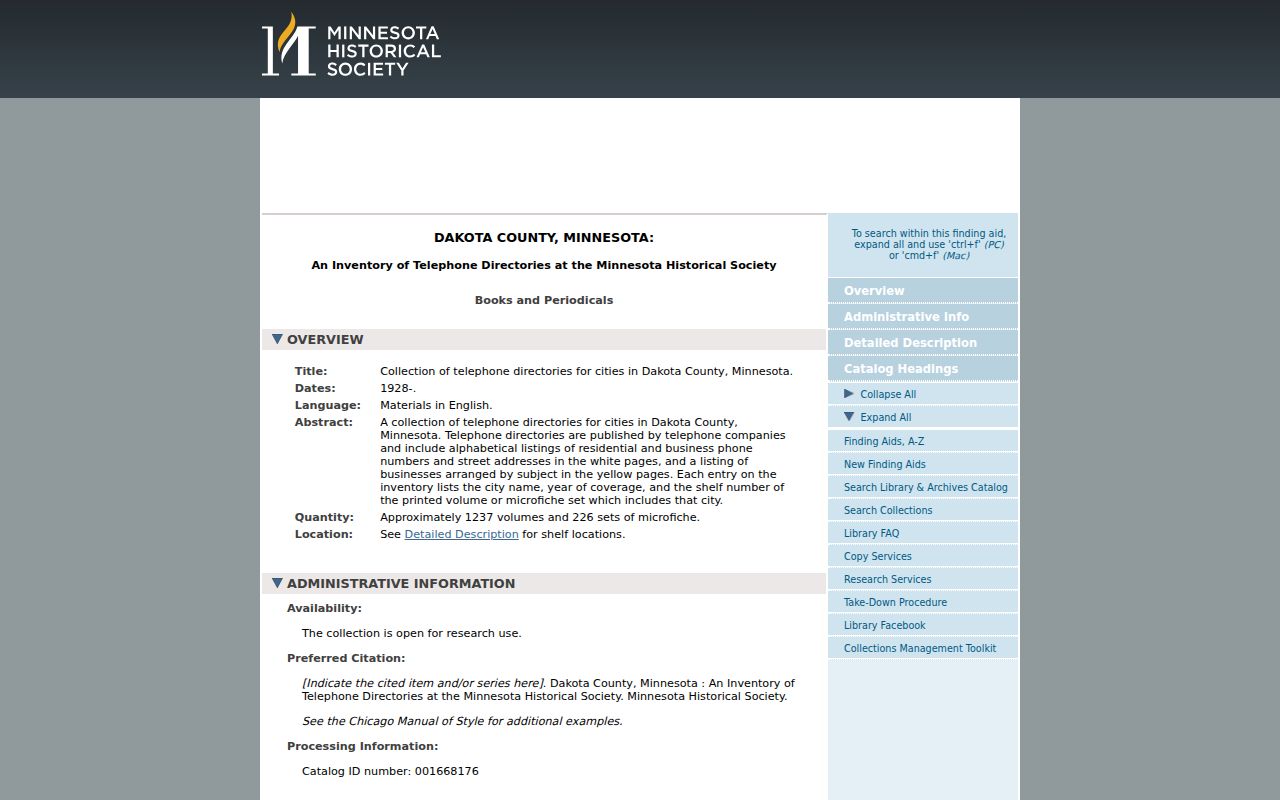
The finding-aid screen is the right place to record a shelf, fiche, or year before requesting the actual historical volume.
For the collection details and how a dated subscriber entry reads, consult the Hastings city directory collections rather than treating telephone listings as a substitute for the recorded land trail.
Hastings Past Households in Census and Obituaries
Past Hastings residents include people who never appear as grantors or grantees. Pair a dated Hastings telephone-directory entry with the appropriate Minnesota state-census or federal census research route, and preserve the locality, roll, page, or image reference. The MNHS guide includes Dakota County state-census material and identifies Hastings and related localities. A Hastings census locality label is not automatically the same as a current city boundary.
Use the Hastings process in sequence: directory year and address, census locality and household, deed or tax context, then newspaper or obituary work for events and family connections. DCHS maintains church, cemetery, census, and World War I biography databases, while its research library has newspaper microfilm, clipping files, photographs, and family-history resources. Its public search page does not expose every field, so a Hastings staff or collection inquiry may be needed.
Hastings household sequence: dated telephone directory → state or federal census locality → deed or tax context → newspaper or obituary evidence.
The Minnesota Historical Society Library describes the Hastings research setting for maps, newspapers, state archives, court and probate material, local government records, school census, vital records, and walk-in databases.
The library resource screen supports the archival handoff when a household trail needs a record that is not a county parcel or deed result.
Lawful use. Use Hastings house-history and family-history records with care. Do not use current or historical address information to stalk, harass, threaten, or harm another person.
Hastings Sanborn House Maps
Hastings Sanborn maps add the building and block layer to the past-residents trail. The Library of Congress provides digitized Hastings editions from March 1884, May 1891, April 1898, November 1904, November 1910, and April 1911. DCHS also identifies some Hastings Sanborn maps from the 1920s in its research-library holdings. Compare the same Hastings block across editions when the question is whether a building or street context changed.
A Hastings Sanborn sheet can show street labels, block arrangement, building footprint, use, and fire-insurance context. It does not provide a complete occupant list. Record the Hastings edition date, sheet number, street label, lot or block reference, and use label, then connect those facts to a directory, deed, tax book, or newspaper. Never turn a building use into the name of a resident.
The Library of Congress Sanborn search guide explains the city and date arrangement for locating a map edition.
Hastings Permit Files and House Changes
Property work can help date a change in a Hastings house history. The City says building and remodeling permits create a historical record of maintenance and remodeling. Its public permit pages list several application categories, but no official address-result database or complete historic retention range was found. A missing web hit does not prove that a permit file was never created.
Ask for a targeted city record with the address, parcel ID, requested category, and date range. Under the Minnesota Government Data Practices Act process, the City can provide inspection, copies, a fee estimate, a statement that no responsive data exists, or the legal basis for withholding nonpublic data. The 2024 annual report recorded 2,162 permits, showing a current body of municipal address records without identifying any individual property.
Note: A permit or code file may date an event at a property, but it does not by itself establish who lived there at the time.
Hastings Newspaper Titles Close Gaps
Newspapers can fill the years between a deed and a directory, especially for property notices, deaths, family events, and local civic references. Search title variants that match the period. The local sequence documented in Library of Congress materials includes the Dakota Weekly Journal beginning in 1856, the Minnesota Conserver beginning in 1861, the Hastings Conserver, the Hastings Independent, the Hastings Gazette, the Hastings Herald, and the Hastings Star. A record missing under one title may be cataloged under another.
DCHS clipping files and newspaper microfilm, along with MNHS holdings and Library of Congress title records, are the verified route for an obituary or notice search. Extract only what is printed, note the exact title and issue date, then compare the event against a vital index, deed, or directory. This is how previous residents research labels inference instead of overstating it.
The county seat moved to Hastings in 1857, a detail that helps explain why county, court, land, and local newspaper records can be found under several custodians. Keep the institution beside each citation when the trail moves from a modern parcel to an archive.